Affiliated Research
- Asset Tagging
- Positioning Buried Pipes and Cables in Urban Environments
- Knowledge and Data Integration and the VISTA Project
- MTU Feasibility Study
The current Mapping the Underworld work aims to build on the promising results of the feasibility study. For more information about the feasibility study, please click here
Creation of the multi-sensor device to locate, map in 3-D and record this information using a single shared platform the position of buried assets forms only part of MTU’s activities. The other complementary research initiatives are:
Asset Tagging
University of Oxford
Led by Dr H J Burd and Professor D J Edwards
The aim of the project is to create a cheap, passive system that may be incorporated within the wall of the pipe and which will resonate when subsequently scanned using GPR. In the initial phase (funded by EPSRC under the MTU umbrella) a system of pipe-mounted passive tags were developed. Tests, conducted at the Gaz de France test site in Paris, confirmed the effectiveness of the system. In the current phase (supported by the EPSRC Follow-On Fund) further development is being conducted to bring the results of the project closer to commercial realisation.
MTU – Asset tagging
- Pipes constructed of plastic and house water or gas can prove very difficult to detect with current methods
- However, plastic is the material of choice for many pipe manufacturers (in the UK)
- Therefore, a system is being developed that incorporates passive ‘tags’ in the pipe to enhance GPR detection
A sister project at Birmingham (Smart Pipes) is investigating the potential to install micro-scale sensors that will provide additional information on the pipe as well as its location.
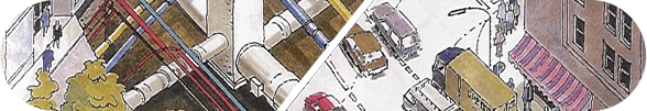
Positioning Buried Pipes and Cables in Urban Environments
University of Nottingham
Led by Dr G W Roberts
Surveying in urban environments provides a severe challenge in being able to accurately determine the position of buried assets. The urban environment with its busy roads and pavements as well as tall buildings provides a challenging environment for both traditional and modern surveying techniques.
The use of GPS in urban areas suffers from the limitation that a line of sight is required between the roving GPS receiver and the GPS satellites. Urban areas with their tall buildings create a “canyon” like environment that restricts the number of satellites visible and thus the ability of the GPS receiver to generate a position solution. Where a position solution is possible, it may suffer from a degradation of the quality due to poor spatial distribution of visible satellites.
This research project, also funded by EPSRC under the MTU umbrella, is investigating various novel surveying strategies to try to improve the ability to accurately position the assets in a crowed urban environment. Such novel strategies included: the use of Laser Scanners; the use of High Sensitivity GPS receivers, the integration of GPS and Total Station data; the integration of GPS with inertial sensors, the use of ground-based transmitters (Locatalites) to augment satellite data; the potential of using multiple satellite constellations such as Europe’s Galileo system, China’s COMPASS and Russia’s GLONASS constellation along with GPS; the integration of GPS and Ground Penetrating Radar (GPR) data; and the use of augmented reality in visualizing the location of the assets.
Knowledge and Data Integration and the VISTA Project
Universities of Leeds and Nottingham
Led by Professor A G Cohn
The research into Knowledge and Data Integration (KDI) is funded by EPSRC under the MTU umbrella and seeks to unify the datasets from utility companies to produce a common approach to recording utility data. VISTA is a follow-on project, funded by the DTI, which aims to advance both the KDI and accurate positioning MTU initiatives with the active involvement of more than 20 companies that make up the direct stakeholder community.
- MTU – 'Visualising Integrated Information on Buried Assets to Reduce Streetworks‘ (VISTA)
- VISTA aims to bring together existing paper and electronic records along with ground based and satellite surveys to produce a unified database
- Utilising this database, various maps may be produced:
- Web based illustrations
- 3-D maps (virtual reality)
- Probabilistic densities of where utilities may be found
For more information, click here to access the main website for VISTA.

Web Design by Darren Langley
