Mapping the Underworld on Radio 4
Mapping the Underworld is the subject of a Radio 4 programme titled Mapping Britain’s Underworld – Friday May 25, 11am.
The Mapping the Underworld research team hosted Adam Hart-Davis for a recent test day to demonstrate MTU technologies and cart development. The day forms part of a programme dedicated to the research being conducted by the MTU team.
The programme will be aired on Friday, 25 May 2012 at 11.00am on BBC Radio 4 and will be available for one week after the broadcast via the BBC iPlayer (its listen on demand facility – http://www.bbc.co.uk).
MTU animated video
Pathways to impact video and podcast
In March 2011 the Mapping the Underworld team hosted an awareness raising workshop to scope how the dissemination of the research carried out by the Mapping the Underworld programme could be further extended to not only the practitioners responsible for locating and implementing the repair and replacement of underground assets but also MPs, highway and traffic management officers and councillors involved in local government to represent the views of their councils, residents and businesses.
Click here to listen to a podcast interview with Dr Nicole Metje, who led this initiative.
The workshop discussions highlighted a number of differing perceptions and expectations of current practice:
- The lack of a common source of accurate data was a frustration expressed several times, as was the perception that poor communication and information sharing remained a problem; although this is beginning to be addressed.
- Across the country different approaches are taken by local authorities. Kent County Council and some London authorities use a permit scheme to coordinate streetworks. Such a scheme currently requires Department for Transport permission.
- The indirect costs of streetworks disruption, particularly when problems arise as a result of inaccurate location need to be taken into account. Repeated, uncoordinated works were a particular frustration for council officer and councillors.
- The owners of the assets need to be involved alongside the contractors, professional networks and local authorities in finding the right solutions to the problems.
- Communication is essential between all parties with an interest along with an understanding of the impact that excessive excavations can have on the industry, other businesses, commuters and local authorities when underground assets cannot be accurately located.
- Coordination and collaboration can be inconsistent and needs to be improved.
- Both the direct and the indirect costs of excavations are of importance when considering the impact of streetworks on the UK economy and the benefits of any potential solutions.
- There are significant issues, challenges and costs arise as the result of different and variable approaches to the location and excavation of buried assets.
- The inability to gather and share data and other information is a major concern.
- Information should be easily and readily available to residents and local businesses on the extent of the works planned.
- There were differing views on whether further regulation is required.
Wheel Process Video
Dr Andrew Foo, a research fellow working on the Low Frequency Electromagnetic Fields Work Package, has produced a video for the blog:
Andrew says:
This video illustrates a wheel attached with a gray-coded panel. The video images, captured at a known frame-per-second rate, are thresholded to produce binary data, and then decoded to calculate the speed and movement of the wheel.
GPR Hardware Video
The Video:
In this MTU-2 project, the GPR hardware is aiming to achieve excellent performance over a wide range of frequencies (150 MHz to 4 GHz, roughly). To do this, hardware configurations with advanced features are requires. In particular, the frequency generating oscillators, which are phase-locked to a common reference crystal, need to sweep across this wide band of frequencies, while still maintaining their signal’s ‘cleanliness’. Recently we have designed (and tweaked) a new hardware using the state-of-the-art synthesiser ADF4350, from Analog Devices Ltd., to fulfil this purpose. This short video gives a ‘feel’ of how this piece of GPR hardware looks and operates. (For further details, feel free to contact Dr. Adham Naji)
Dr. Adham Naji is one of the Research Fellows on the Ground Penetrating Radar Work Package. He has created a tour of some of the GPR Hardware he has been working on in the labs at the University of Bath.
February Event: In Pictures
The MTU Annual Event took place in February 2010 and was widely deemed to be a great success. We are in the process of producing an event report which will be posted as soon as possible. In the meantime, here is a pictorial roundup of the day.
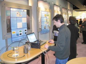
Technology demonstrations and poster presentations.
Prototype equipment on display with MTU researchers on hand to demonstrate the technology behind the sensors.
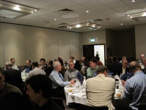
The lively networking dinner on the evening of the 24th.
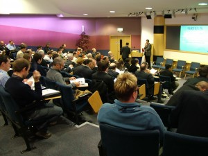
Excellent attendance from a wide range of sectors, both academic, industry partners and public sector representatives. We were proud to host a large international presence, including delegates from the United States and the Far East.
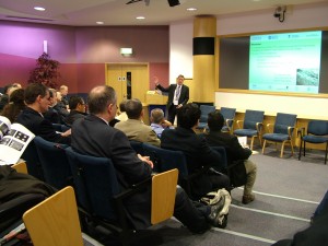
A broad range of short presentations continued throughout the day, outlining the latest development in the project while generating discussions among the audience.

- Technology demonstrations and poster presentations.
- Prototype equipments were set up and the researchers were present to demonstrate the technology underpinning the sensors.
- There were also posters set up for browsing at leisure.
GPR2008 Proceedings Available
The complete proceedings from the GPR2008 conference are now available to purchase. Please click here to be directed to the University of Birmingham’s secure online shop.
For more information about GPR2008, click here to visit the website.
Research Progress
Mapping the Underworld research continues to move forward on each Work Package, and within the team as a whole. For an update on our recent research progress, see our April 2010 Research Update.
MTU Event: February 25th 2010
On February 25th 2010, Mapping the Underworld is holding its annual dissemination event. The event will be held at the Ordnance Survey Business Centre in Southampton, and is a joint event with ORFEUS (Optimised Radar to Find Every Utility in the Street).
MTU will be detailing its research progress so far, and topics covered on the day will include:
- sensor technology developments
- a practitioner view of the problems at the interface between utility detection and streetworks
- an overview of the problems faced in the USA and an outline of the new US research programmes
- data fusion: combining sensor outputs with utility record
- ORFEUS’s advances and their applicability to current thinking.
More information about this event will be posted soon. For now, please hold this date: February 25th, 2010.
Booking a Place
Online bookings can now be made: click here.
Please note that there is no charge for attendance at the Mapping the Underworld Workshop for the official MTU project partners.
Welcome
Welcome to Mapping the Underworld’s new website. This is our blog, which will be used for brief updates and summary information about the project as a whole. We have a number of interesting posts in the pipeline, so please keep checking back or subscribe to our feed to keep up to date.


